

Included in the box: echoMAP UHD, power/data cable, stern sensor
(depending on the version), quick release swivel base, recessed base, protection cap,
G3 map of Greece, instructions, 4-pin to 5-pin NMEA 2000 cable adapter
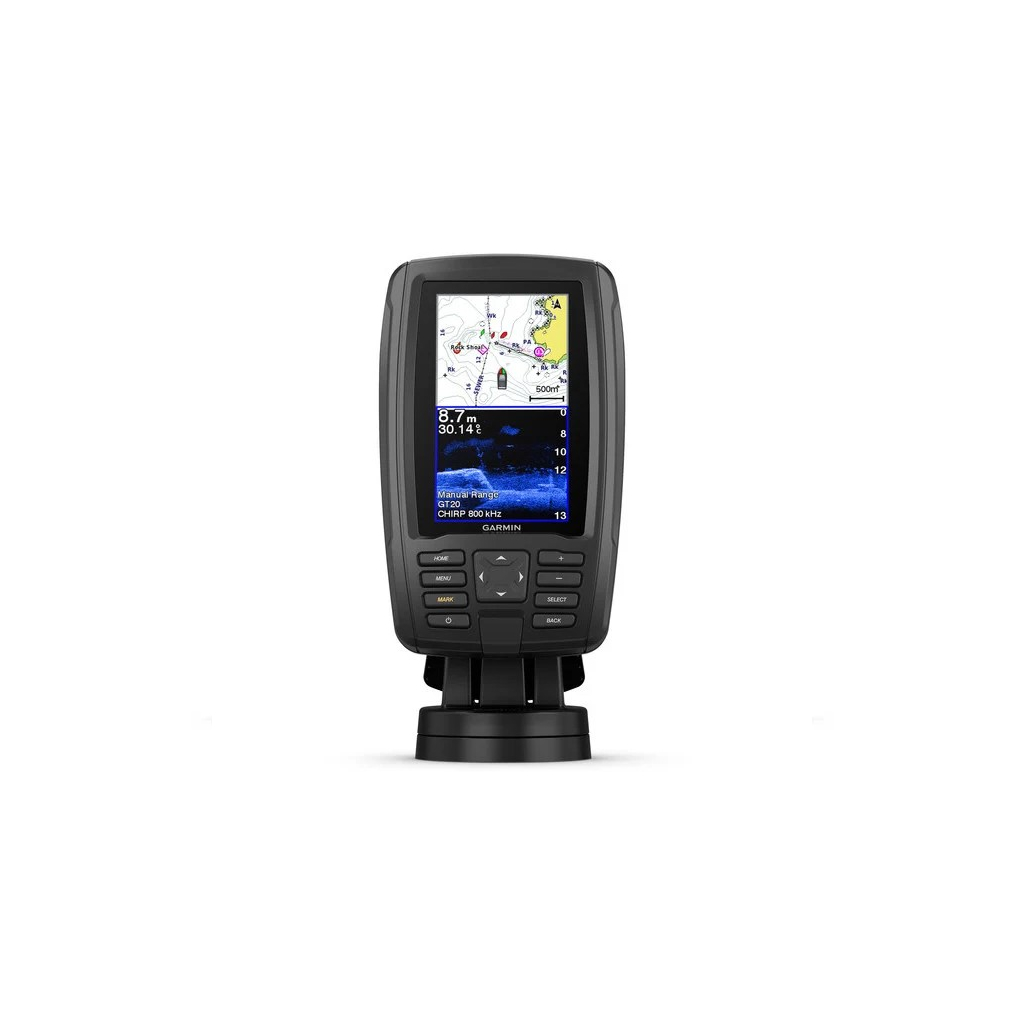
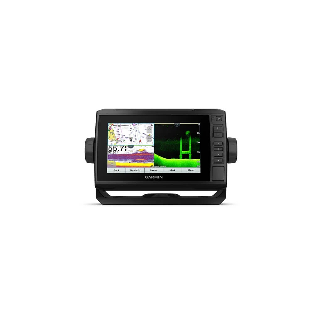
GPS Plotter and depth finder/fish finder with interface capabilities
Bright, sun-readable 6-inch screen
Built-in CHIRP sonar and additional CHIRP ClearVü™ for bottom scanning
NEW Ultra High-Definition ClearVü
NEW Ultra High-Definition SideVü
NEW Integration with the Force™ engine – –
The package includes a BlueChart g3 HD detailed map for automatic route calculation2 and unique data accuracy
Quickdraw Contours software installed to make your personal fishing maps on-screen with levels at 30 cm
Use the built-in Wi-Fi® to connect to the ActiveCaptain™ app and access OneChart™, smart notifications1, Garmin Quickdraw™ community data and more
Share points and courses with other ECHOMAP™ or STRIKER™ devices
Bright, sun-readable 6-inch display and support for clear traditional Garmin CHIRP and CHIRP ClearVü™ depth-scan sonar. It comes with a BlueChart g3 HD all-sky map that includes a fishing map, navigation map, 3D above and below sea surface imaging, aerial photos and gives the plotter automatic course calculation capability. With Quickdraw Contours software you instantly create your personal fishing charts on-screen with levels at 30cm as you fish. Plus, it has built-in Wi-Fi® for pairing with the free ActiveCaptain app to access OneChart, allowing you to manage your charts. ActiveCaptain gives you access to smart alerts1, the ActiveCaptain community for marinas and other points of interest, Quickdraw community data and more. You can even share points and courses with other ECHOMAP ;or STRIKER devices Includes an easy-removal mount to easily remove the plotter from your boat.
The Garmin CHIRP difference
The sonar capabilities of the echoMAP Plus 62cv include traditional CHIRP sonar, one of the most advanced sonar technologies for fishing on the market. Traditional CHIRP sonar offers impressive target detection and separation because it puts even more energy on the target than traditional sonar.
Clear bottom scan imaging
The Garmin CHIRP ClearVü™ bottom-scanning sonar gives you near-photographic imaging of what’s underneath a boat. You can see structures, submerged objects and fish.
Quickdraw Contours to create your own maps
Instantly create personalised on-screen fishing maps with levels at 30 cm. Adapt them to your needs. These maps belong to you. Keep them to yourself or share them if you want with the Quickdraw community on Garmin Connect.
Connect to the ActiveCaptain app
The free ActiveCaptain app allows you to manage your on-board experience from almost anywhere. It creates a simple and powerful connection between the plotter and the smartphone/tablet, maps and community. Use the device’s built-in Wi-Fi® to connect it to the ActiveCaptain app to access OneChart for map management. See smart notifications for calls or messages on your plotter1 screen and access the ActiveCaptain community for marinas and other points of interest, Quickdraw data and more.
Functions for SailAssist sailing
SailAssist features include laylines, advanced wind graph and heading and course lines. See the angle and speed of the actual and apparent wind as well as the set & drift data at a glance. To help you get the maximum advantage from the wind, the pre-race guidance page shows you the virtual start line along with data fields showing laylines, pre-start time and race timer.
Take ECHOMAP Plus with you
When you are not in the water keep the ECHOPMAP Plus safe. There is no need to remove cables from the device as all cables are connected directly to the base. This allows you to quickly insert and remove the ECHOMAP Plus from the power supply and base.
1.When connected to a compatible mobile device
2.The automatic course calculation function is for programming and is not a substitute for safe handling of the vessel